Background
Planning ahead: Refuge identification and mapping
During drought, aquatic plants and animals survive in refuge habitats - that is, areas where the effects of drought are less severe than elsewhere. These refuges appear to be a crucial key to the survival and recovery of aquatic ecosystems experiencing the trauma of drought.
As a drought progresses, refuge habitats will become increasingly hard to find in many streams. They may occur kilometres apart in small streams or hundreds of kilometres apart in large dryland rivers - a long way 'between drinks'.
Identifying refuge habitats (from Bond 2007) (see also 'Refuge habitats')
Q. What are the characteristics of a refuge habitat?
A. There is no one set of characteristics. Here are some:
- Moisture or water is retained in the refuge throughout the drought.
- It is large enough to give the biota room to move, e.g. a large pool for large fish or turtles; a hole in the bank or pore space in the sediment beneath riverbed cobbles or snags for macroinvertebrates, or perhaps frogs or mussels.
- There is an adequate food supply for the period between rains for particular biota.
- The water quality and temperature remain within tolerable ranges for particular biota right through the drought.
- Intrusion by livestock or humans is minimal.
In intermittent streams, refuges include isolated pools where fauna are protected from drying out;
In perennial flowing streams, including those that continue to flow throughout the drought, refuge habitats may consist of cool shaded gullies or places receiving incoming cool groundwater that provide vital protection from temperature extremes for plant and animals.
Because the physical characteristics of rivers or streams differ from place to place and from time to time, the habitat features that confer resistance and resilience to drought - thereby creating a refuge - will also differ. And different species will perceive different habitats as refuges.
Perennial streams during drought are often reduced to a series of pools, but some species, e.g. some kinds of fish that are adapted to flowing water rather than pools, will not be able to tolerate the poor water quality that develops in pools. For these less tolerant species, the pools are not an adequate refuge. These species will only be likely to survive in a stream or section of stream where water is still flowing. Such areas are more likely to be found in spring-fed streams, confined valleys, and in some cases the larger downstream sections of the river network.
In streams that normally stop flowing in the dry season, many freshwater species find refuge in permanent pools in the stream channel, despite even these often having high water temperatures and low oxygen content. These biota are adapted to survive the conditions that develop seasonally in these pools.
Such pools can act as critically important local refuges for more tolerant species. In the Lerderberg River, for example, Closs and Lake (1996) observed that, during drought, the relatively tolerant native fish species Galaxius olidus was able to survive in isolated pools, while the more finicky introduced species Salmo trutta was wiped out by the high temperatures. See also McNeil (2004) for an account of survival in isolated billabongs in Victoria.
Mapping refuge habitats
Q. How do we go about mapping refuges?
A. Surveys, on foot, by air, or possibly from satellite.
Up till now, much of our understanding of river condition and hydrology has come from site-based monitoring and gauging. However, this approach has its limitations. For locating and mapping refuge habitats, surveys appear to be the most useful techniques.
Once a manager knows what refuge habitats are present, it's important to ensure that these are robust to physical disturbances - both natural and artificial, present and future - so that they can fulfil their role in drought recovery. This could well require active management and restoration, which also represents a proactive step towards dealing with future droughts.
Ground-based surveys
Ground-based surveys along rivers or streams can be achieved fairly simply. Individuals or teams follow the path of the stream, using hand-held GPS units to locate key features, such as isolated pools or the start and endpoint of a flowing section, or relatively small-scale characteristics such as in-stream wood or riverbank vegetation, which indicate possible refuge habitats.
Some catchment management authorities are already employing this approach. Ground-based mapping has several advantages:
- a quick start-up time,
- little training required,
- low initial costs and
- ability to record anecdotal observations.
Disadvantages include:
- ongoing labour costs,
- relative slowness (especially over large areas),
- practical constraints, and
- access problems due to terrain and private property.
Airborne surveys (remote sensing)
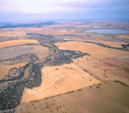
To locate even small-scale refuge habitats, which can also be isolated from each other, it will be best to make a continuous survey of the river network - not just a bit here and there.
In Australia, recent trials have indicated the effectiveness of aerial surveys, using helicopters or low flying planes, in locating isolated pools in small intermittent streams.
In the United States, airborne remote sensing has proved particularly effective at identifying refuge habitats such as thermal refuges (waters at suitable temperatures) for salmon and trout.
Remote sensing by airborne survey has these advantages:
- speed and large coverage,
- comparative cheapness (per km),
- choice of plane or helicopter use,
- collection of a diverse array of data (including visual and thermal imagery),
- capacity to see channel and floodplain morphology,
- IR imagery, and the fact that
- data are stored and available for future unforeseen uses (for example, mapping erosion or willows).
Disadvantages include:
- the planning involved,
- the processing of data may require considerable knowledge and adds to the expense, and
- large initial costs for plane-based surveys.
Expanding those dot points, remote sensing approaches to mapping allow collection of a much greater range of data. Arguably, despite their seeming high initial costs, they can be relatively cost effective if large sections of stream are to be surveyed. They are much more time-efficient once the planning phase has been completed. Therefore, simply flying over streams in a helicopter is a relatively inexpensive approach that can yield satisfactory results even using hand-held GPS units and simple note taking.
More sophisticated approaches, combining a range of sensors, allow key features such as surface water (whether continuous or fragmented) to be identified even through overhanging vegetation - a problem that plagues visual sensors when used on small streams. A field trial using sensors to map refuge pools was recently run in South Australia as part of an eWater CRC project, and we hope to validate it over a larger area in due course.
There is an additional benefit associated with plane-based surveys: that is, that you can interpret a variety of information from the scanners, aside from the presence of potential refuge habitats.
Satellite survey
For the really serious, remote sensing by satellite will cover a very large area, but there is limited availability of suitable satellite imagery at this stage, resolution may be insufficient for smaller streams, and it is still costly.
Useful references:
Downloads:
- Bond (2007),
- McNeil (2004)
Keywords:
Topics:
| Principels for protecting aquatic biodiversity | View Frequently Asked Questions | View Bibliography |
| Refuge habitats | View Frequently Asked Questions | View Bibliography |